Chapter III
Numantia and its Surroundings
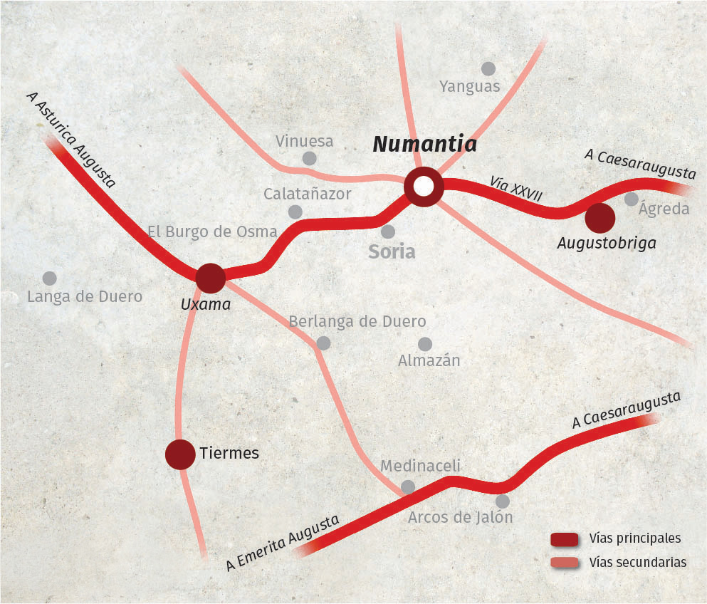
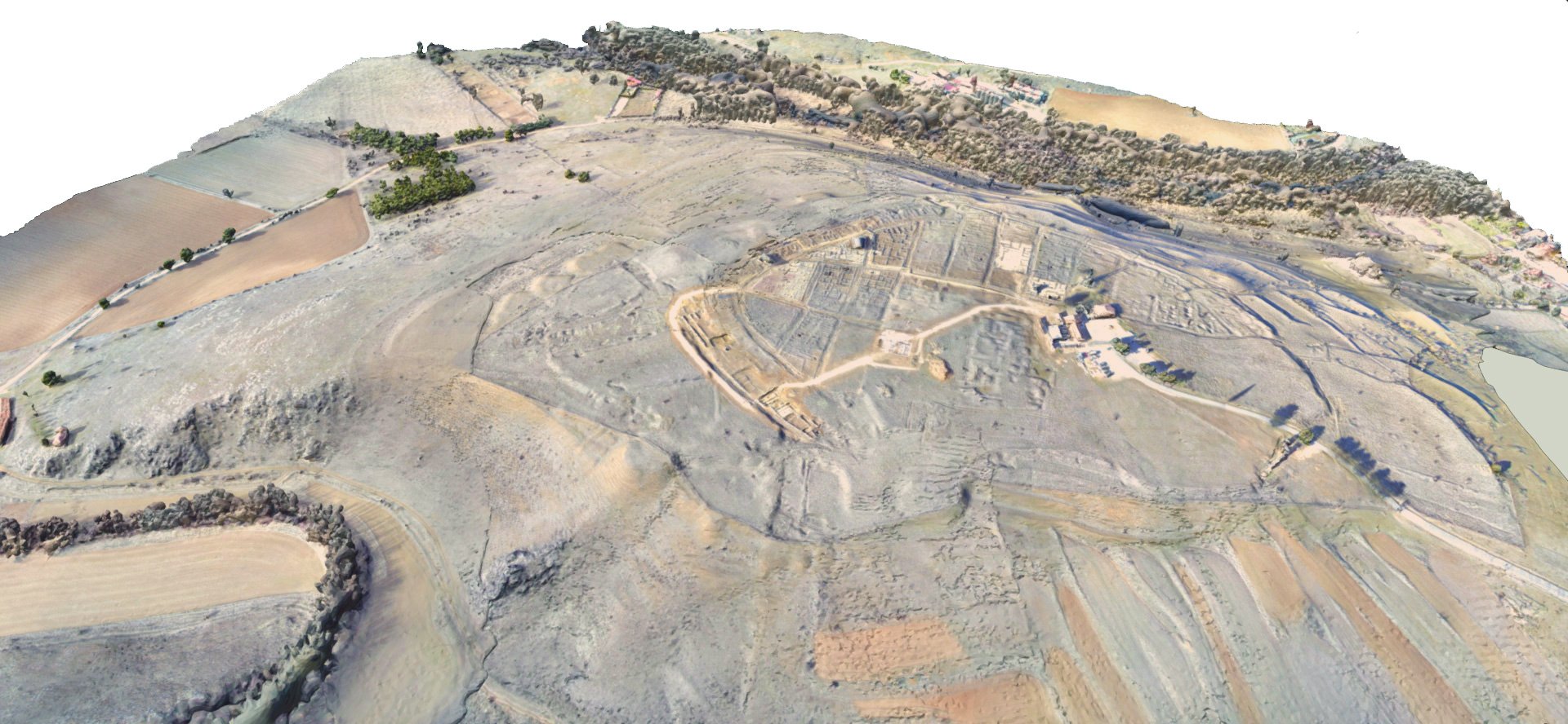
Numantia sits on the high, broad hill called Cerro de La Muela, looking out from there over a sweeping plain cut off by the mountain peaks of the Iberian System, from the Sierras de Urbión to the west, to the peaks of Moncayo to the east. The plain and the sierra bear a complex, weather-dependent relationship, marked by storms and the spring thaw. The plain is crossed by the River Douro, born as a mountain stream and then swollen by numerous tributaries and brooks that take most of their current from the thawed snow of the high wooded valleys and livestock pastures of the northern sierra; among the most important are the Merdancho and Tera, which flow into the Douro at the foot of Numantia itself.
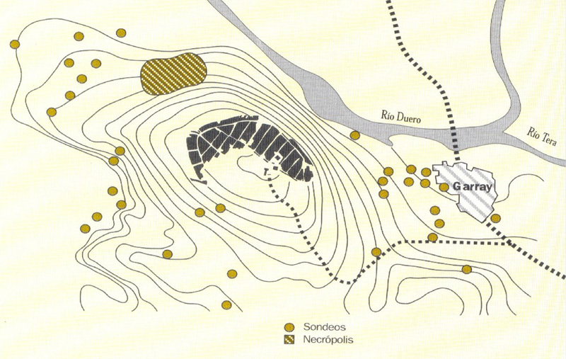
Its strategically important position is further reinforced by the convergence thereon of all paths fanning in from the northern sierra to cross the rivers Douro and Tera at the point where they join each other. This enables transhumant livestock to move from lowland winter pastures to upland summer pastures. These droveways communicate the High Douro with the Ebro valley through the mountain passes of Piqueras and Oncala. They then join up with the pathways communicating the Ebro Valley to the east with the high plateau land (Meseta), especially the pathway of the River Queiles, converted in Roman times into the renowned XXVII road of the Antonine Itinerary, running from Caesaraugusta (Zaragoza) to Asturica (Astorga).
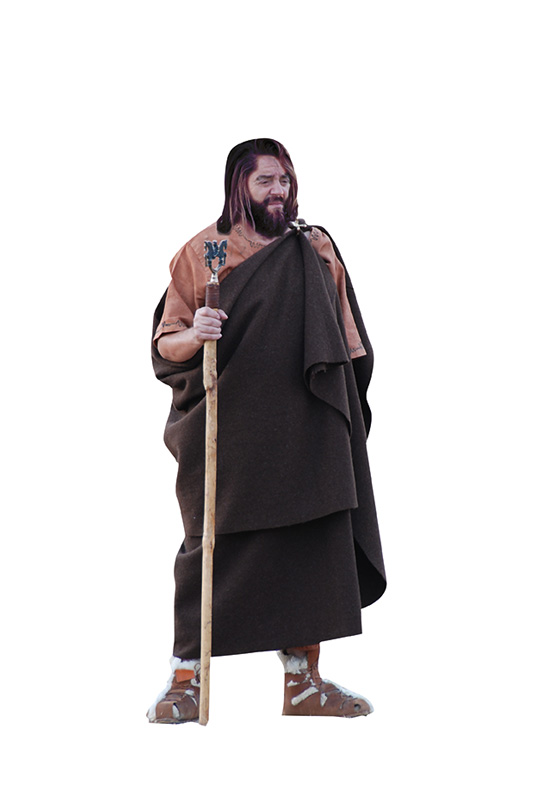
According to Appian “it was surrounded by thick woods”. This would have implied a high rate of humidity, reflected also in a bigger current of the River Douro. At that time, indeed, the river was navigable. Merchants transporting wine and cereals came right up the river “in small skiffs (...) with the aid of sails”. The texts speak of a wooded, marshy environment with rich pastures for rearing goats and sheep, the main livelihood of the area. Their wool was used to make clothing, pride of place going to the Roman military garment, the sagum.
The wartime taxes levied on Celtiberian cities always feature thousands of these garments (in 141 BCE Numantia and Termes supplied 9000). The local asses, horses and mules were quick, surefooted and sturdy, so the Romans largely switched to them instead of Italian beasts of burden.
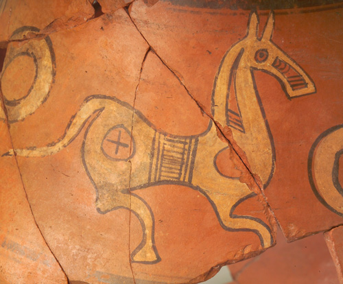
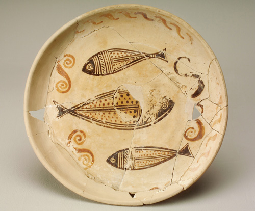
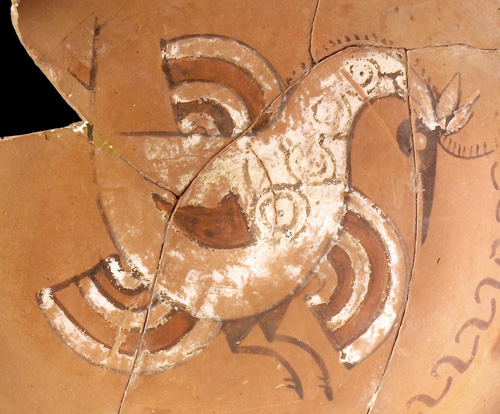
The Numantine scenery was made up by mistletoe-thronged Scots- or black-pines intermingled with acorn-bearing members of the Quercus genus like Pyrenean and gall oaks. There were also some Juniper groves, producing excellent timber for building purposes. Esparto grass is also mentioned, indicating the existence of dry pastureland and rich riverside vegetation, with tree species such as elm, ash, willow and walnut, growing alongside rivers, lakes and in alluvial zones. The associated fauna included domesticated animals like sheep, goat, horse and bull plus wild animals like red deer, wild boar, rabbit, hare, lynx, bear and wolf. The ceramic decoration shows birds like doves, partridges, crows, eagles, vultures, hoopoes, lapwings, herons plus fishlife like trout and also some insects.
Gallery of chapter images
go on to chapter IV >>>Numantia in the Celtiberian Context
Bibliographical references
- García Heras, Manuel (1998). Caracterización arqueométrica de la producción cerámica numantina, BAR. International Series, 692. Oxford.
- Jimeno Martínez, Alfredo (1992). “Las cerámicas de Numancia”, Arevacon, Asociación de Amigos del Museo Numantino, XVII. ISSN: 2254-1888.
- Jimeno Martínez, Alfredo (2007). “La Numancia celtibero-romana en el marco territorial del Alto Duero”. En Milagros Burón Álvarez (coord.): Patrimonio cultural y territorio en el Valle del Duero, pp. 16-18.
- Jimeno Martínez, Alfredo, José Ignacio de la Torre y Antonio Chaín Galán (2010). “Ritos funerarios y mitos astrales en las necrópolis celtibéricas del Alto Duero”. En Francisco Burillo Mozota (coord.): Ritos y mitos: VI Simposio sobre Celtíberos, Zaragoza, pp. 369-390. ISBN: 978-84-613-7726-8.
- Liceras Garrido, Raquel y Alfredo Jimeno Martínez (2016). “Aproximación al modelo de explotación de recursos en el territorio de Numancia”. En María del Carmen Mínguez García y Enrique Capdevila Montes (coord.): Manual de Tecnologías de la Información Geográfica aplicadas a la Arqueología, Madrid, pp. 137-158. ISBN 978-84-451-3539-6.
- Liceras Garrido, Raquel (2014). “Sobre el territorio de los numantinos”. En José Honrado Castro, Miguel Ángel Brezmes Escribano, Alicia Tejeiro Pizarro y Óscar Rodríguez Monterrubio (coord.): Investigaciones Arqueológicas en el valle del Duero, II (Neolítico y Calcolítico en el valle del Duero), pp. 177-190. ISBN: 978-84-940699-6-3.